[van Wytfliet, Cornelius]
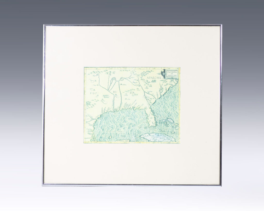
Florida et Apalche. [Facsimile 16th Century Map of Florida].
[Louvain, Belgium] : Cornelius de Wytfliet, [1597].
Facsimile reproduction of the original Flemish 1597 Cornelius van Wytfliet map, one of only three maps printed prior to 1600 to depict the area with any accuracy and one of the earliest maps to refer to the region as Florida. One page, the map is based on Geronimo de Chaves’ map, which was copied byContinue reading "Florida et Apalche. [Facsimile 16th Century Map of Florida]."
Read more$400.00
Item Number: RRB-138762


![Florida et Apalche. [Facsimile 16th Century Map of Florida].](https://raptis.bvbeta.com/wp-content/uploads/2026/01/RRB-138762.jpg)


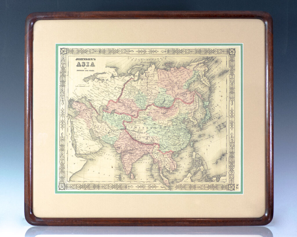
![Asia. [Nathaniel and Simeon Smith Jocelyn Nineteenth Century Engraved Map of Asia].](https://raptis.bvbeta.com/wp-content/uploads/2026/01/RRB-137394.jpg)
![Empire Chinois et Japon. [Nineteenth Century Conrad Malte-Brun Map of the Chinese Empire] [China].](https://raptis.bvbeta.com/wp-content/uploads/2025/12/RRB-137350.jpg)
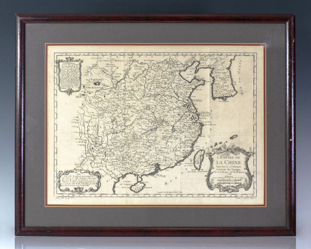
![L’Empire de La Chine Pour Servir a l’Histoire Generale des Voyages. [Eighteenth Century Jacques-Nicolas Bellin Map of China].](https://raptis.bvbeta.com/wp-content/uploads/2026/01/RRB-137234.jpg)
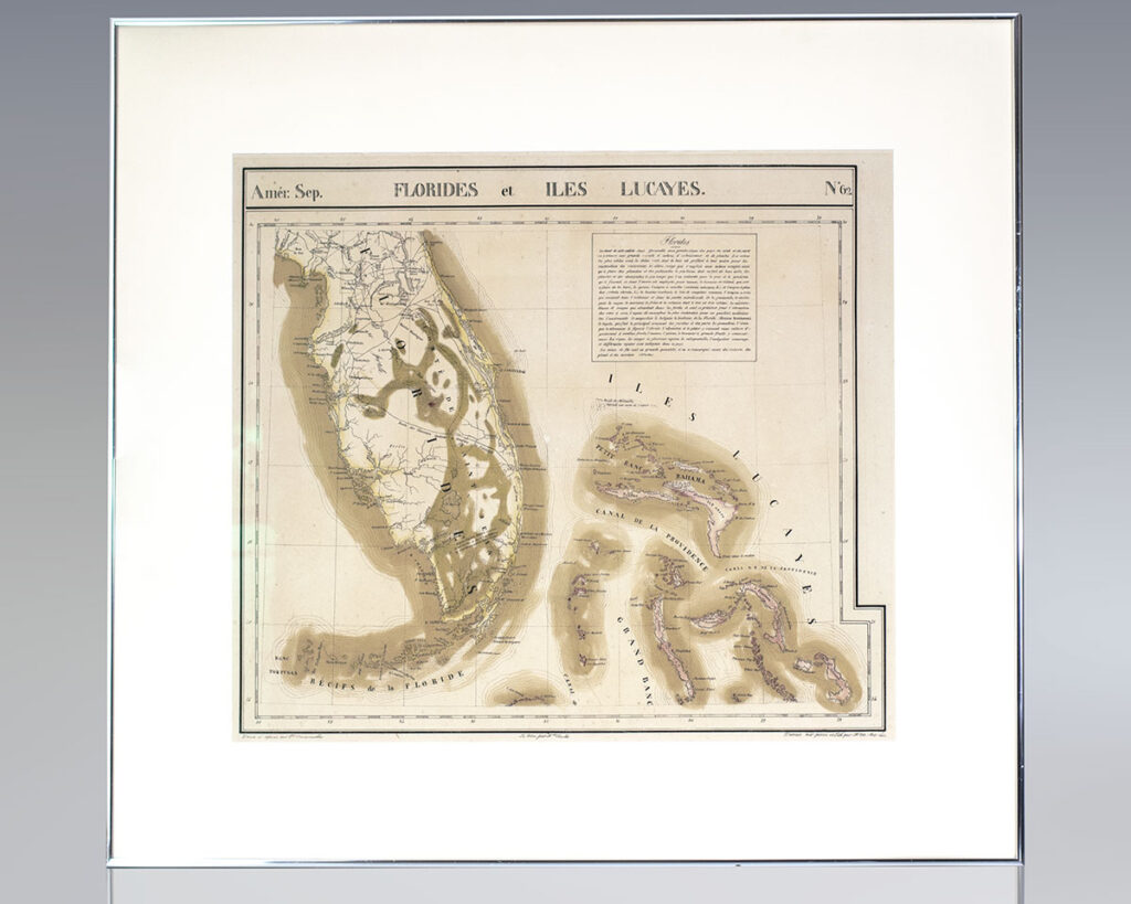
![Amérique Septentrionale. Florides et Iles Lucayes. No. 62. [Map of Florida and the Bahamas].](https://raptis.bvbeta.com/wp-content/uploads/2026/01/RRB-137108.jpg)


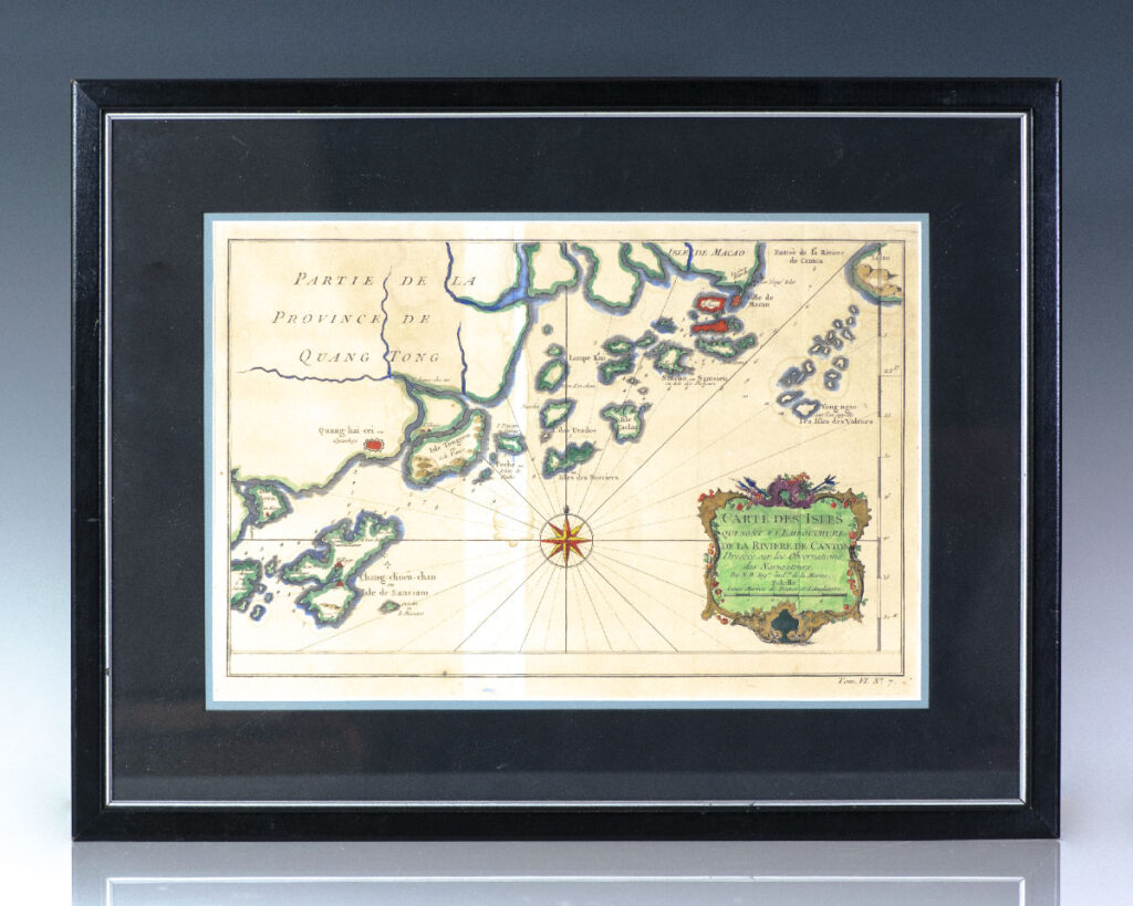
![Carte Des Isles Qui Sont a l’Embouchure de la Riviere de Canton. [Eighteenth Century Map Of The Islands Which Are At The Mouth Of The Canton River].](https://raptis.bvbeta.com/wp-content/uploads/2025/12/RRB-137244.jpg)