LIZARS, Daniel.
Daniel Lizars 19th Century Map of the United States.
Edinburgh: Published by D. Lizars , [1828].
$1,250.00
In Stock
Item Number: RRB-146295
+$450
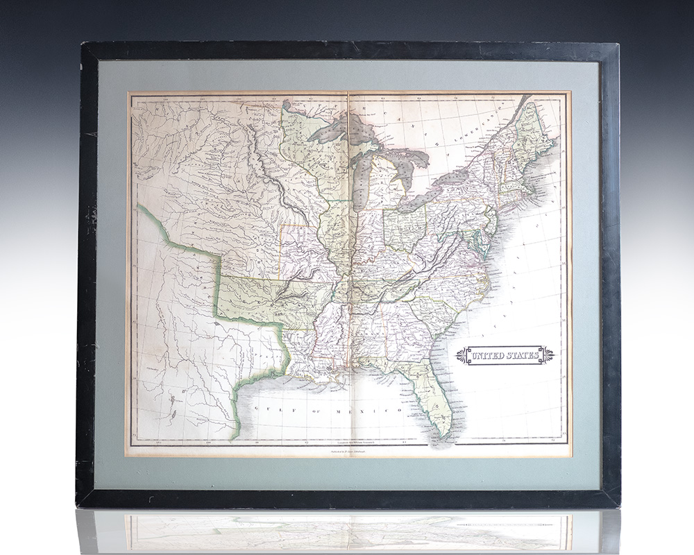
Rare Hand-colored engraved nineteenth century folding map of the United States by renowned Scottish cartographer Daniel Lizars
Hand-colored engraved nineteenth century folding map of the United States by renowned Scottish cartographer Daniel Lizars. The hand-colored engraved folding map covers the territories of the United States circa 1828 extending as far west as the Missouri Territory, Arkansa [sic], and Louisiana. In very good condition with splitting to the central fold. Matted and framed the entire piece measures 24.5 inches by 21 inches.
Daniel Lizars 19th Century Map of the United States.
$1,250.00
In Stock