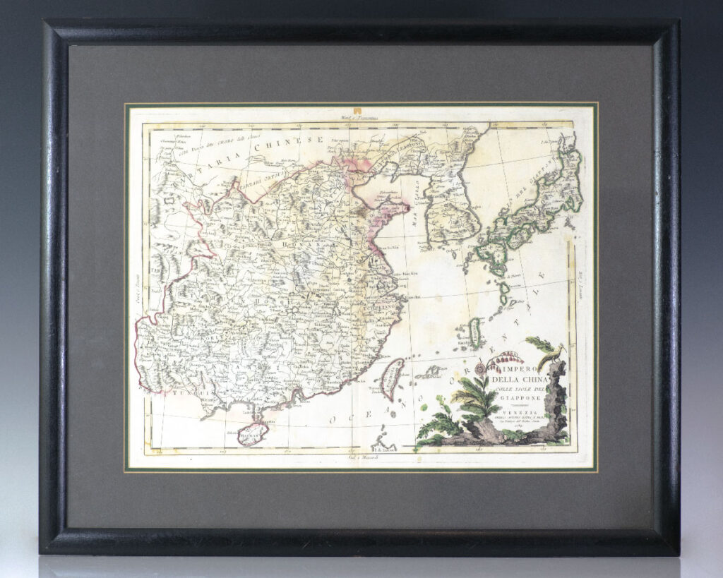
Zatto, Antonio [China]
Impero Della China Colle Isole Del Giappone. [Eighteenth Century Antonio Zatta Map of the Empire Of China and Islands Of Japan]
Venice : Presso Antonio Zatta, 1784.
Large eighteenth century hand-colored map of China and Japan by Venetian cartographer Antonio Zatta. One page, hand-colored with a fine botanical cartouche. In near fine condition. The entire piece measures 19.5 inches by 23.5 inches.
Read more$500.00
Item Number: RRB-137611


![Impero Della China Colle Isole Del Giappone. [Eighteenth Century Antonio Zatta Map of the Empire Of China and Islands Of Japan]](https://raptis.bvbeta.com/wp-content/uploads/2026/01/RRB-137611.jpg)
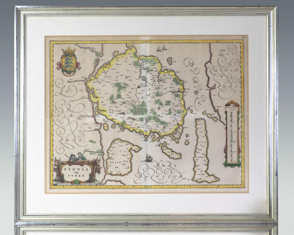
![Fionia vulgo Funen. [Seventeenth Century Joan Blaeu Map of Funen].](https://raptis.bvbeta.com/wp-content/uploads/2025/12/RRB-137508.jpg)
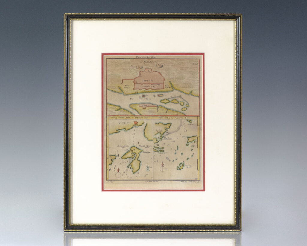
![Jean-Baptiste Du Halde Map of China: Kanton, Shang Chwen Shan and Ma-kau. [Description Geographique].](https://raptis.bvbeta.com/wp-content/uploads/2025/12/RRB-137249.jpg)


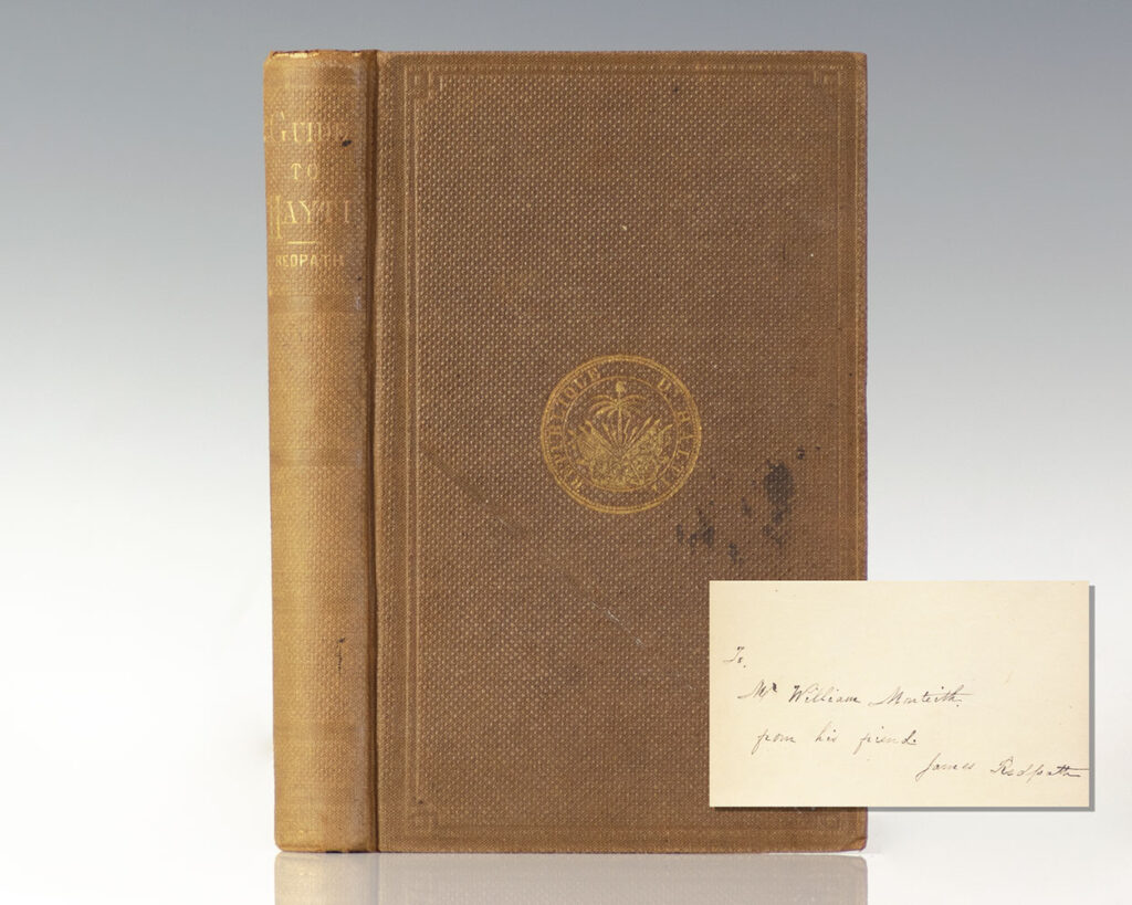
![A Guide to Hayti [Haiti].](https://raptis.bvbeta.com/wp-content/uploads/2026/01/rrb-134221.jpg)
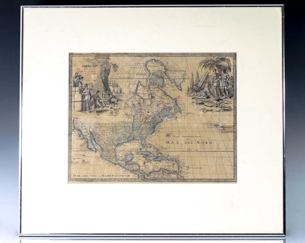
![America das Mitternachtige nach der Zeichnung des Herrn Wilhelm Delisle in Verlag Joh. Justine Gebauers. [18th Century Guillaume Delisle Map of North America].](https://raptis.bvbeta.com/wp-content/uploads/2026/01/RRB-138497.jpg)
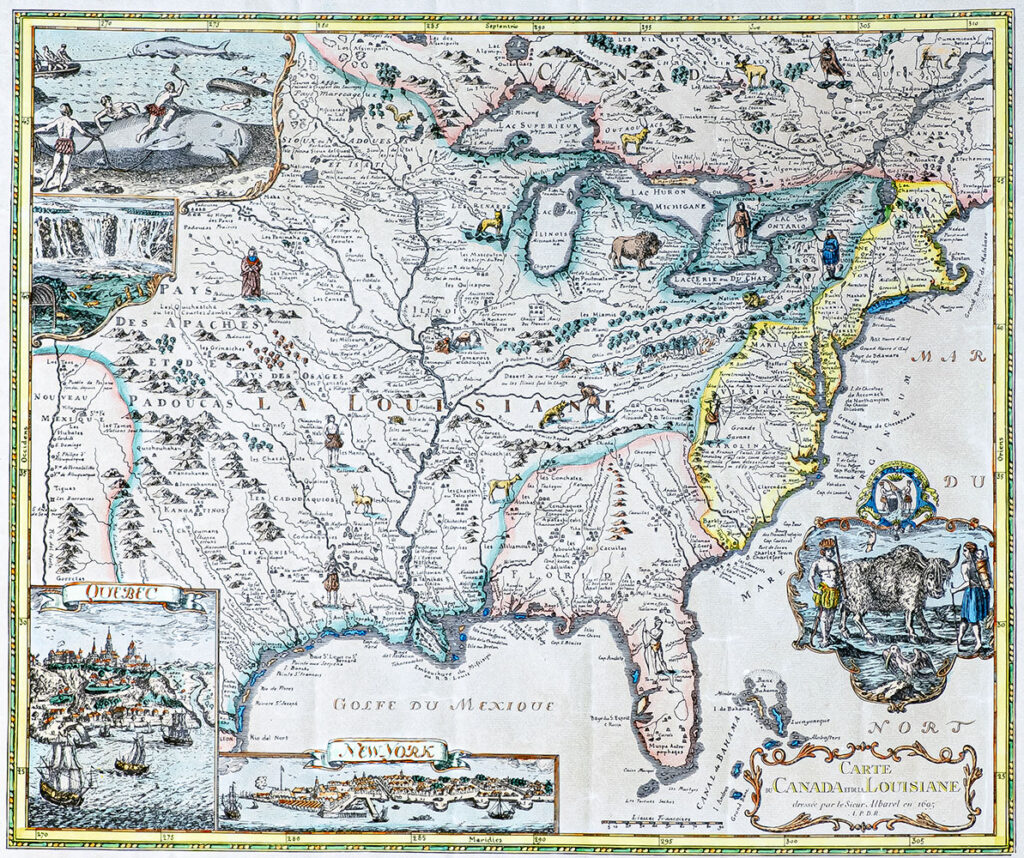
![Carte Canada et de la Louisiane. [The Albarel Map].](https://raptis.bvbeta.com/wp-content/uploads/2025/12/RRB-138509.jpg)
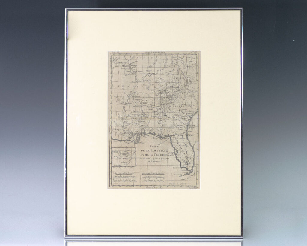
![Carte De La Louisiane Et De La Floride. [18th Century French Map of Florida].](https://raptis.bvbeta.com/wp-content/uploads/2026/01/RRB-139014.jpg)


![La Floride, Suirvant les Nouvelles Observations de Messrs de l’Academie Royale des Sciences, etc. [17th Century Map of Florida and America].](https://raptis.bvbeta.com/wp-content/uploads/2025/12/RRB-138431.jpg)