Sartine, Antoine de
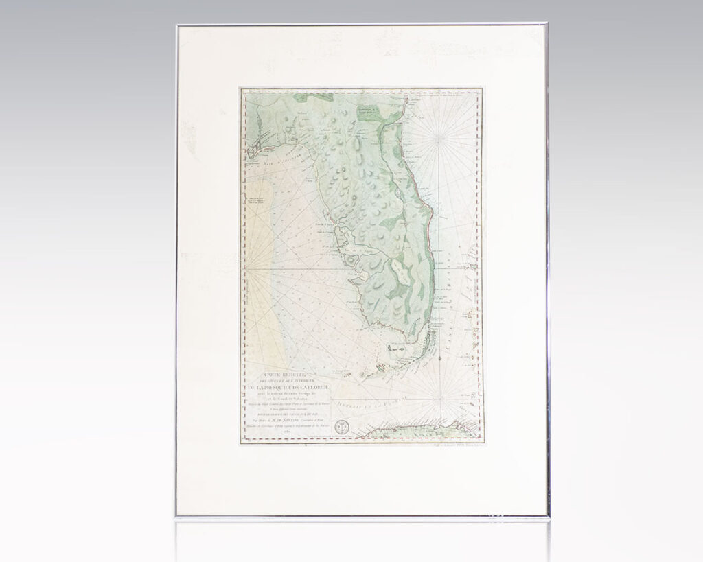
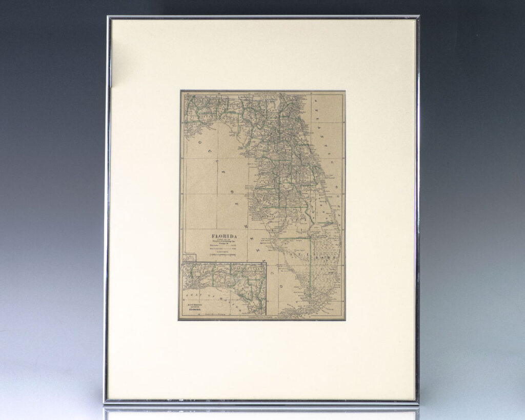
Carte Reduite des Cotes et de l’Interieur de la Presqu’ile de la Floride, avec le Detroit de Cette Presqu’ile et le Canal de Bahama. [18th Century Anotoine de Sartine Map of Florida]
France : Dépôt General de la Marine, 1780.
Rare 18th century hand-colored engraved map or the state of Florida published for the use of the French Navy during the American Revolution. One page, the map shows coastal topography around the Florida Peninsula depicting harbors, points, keys, shoals and low water areas, the St. John’s River, St. Augustine, Cape Canaveral, Charlotte Harbor, Tampa Bay,Continue reading "Carte Reduite des Cotes et de l’Interieur de la Presqu’ile de la Floride, avec le Detroit de Cette Presqu’ile et le Canal de Bahama. [18th Century Anotoine de Sartine Map of Florida]"
Read more$5,000.00
Item Number: RRB-138716


![Carte Reduite des Cotes et de l’Interieur de la Presqu’ile de la Floride, avec le Detroit de Cette Presqu’ile et le Canal de Bahama. [18th Century Anotoine de Sartine Map of Florida]](https://raptis.bvbeta.com/wp-content/uploads/2026/01/RRB-138716.jpg)
![The Poetical Works of Henry Wadsworth Longfellow. [Fore-edge Painting].](https://raptis.bvbeta.com/wp-content/uploads/2025/12/RRB-138812.jpg)
![The New Whole Duty of Man, Containing the Faith as well as Practice of A Christian: Made Easy For the Practice of the Present Age, AS the Old Whole Duty of Man was design’d for those unhappy Times in which it was written: And Supplying the Articles of the Christian Faith, Which are Wanting in that Book. Though Essentially Necessary to Salvation. [Fore-Edge Painting].](https://raptis.bvbeta.com/wp-content/uploads/2025/12/RRB-138215.jpg)
![The Vicar of Wakefield: A Tale. [Fore-edge Painting].](https://raptis.bvbeta.com/wp-content/uploads/2025/12/RRB-138744.jpg)


![The Book of Common Prayer and Administration to the Sacraments, and Other Rites and Ceremonies of the Church, According to the Use of The United Church of England and Ireland: Together with the Proper Lessons For Sundays and Other Holy-Days. [Double Fore-edge Painting].](https://raptis.bvbeta.com/wp-content/uploads/2025/12/RRB-138444.jpg)


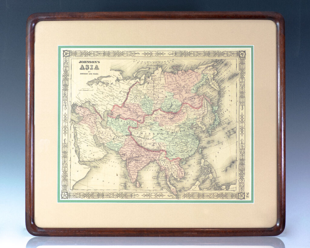
![Asia. [Nathaniel and Simeon Smith Jocelyn Nineteenth Century Engraved Map of Asia].](https://raptis.bvbeta.com/wp-content/uploads/2026/01/RRB-137394.jpg)
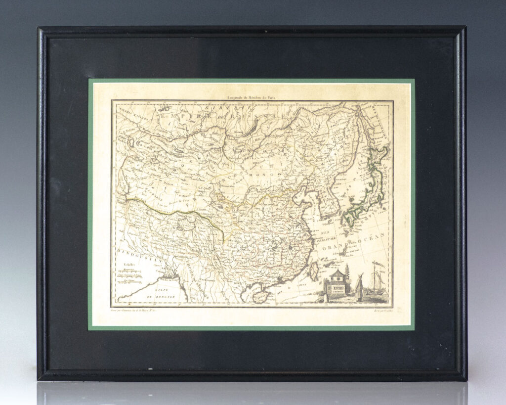
![Empire Chinois et Japon. [Nineteenth Century Conrad Malte-Brun Map of the Chinese Empire] [China].](https://raptis.bvbeta.com/wp-content/uploads/2025/12/RRB-137350.jpg)
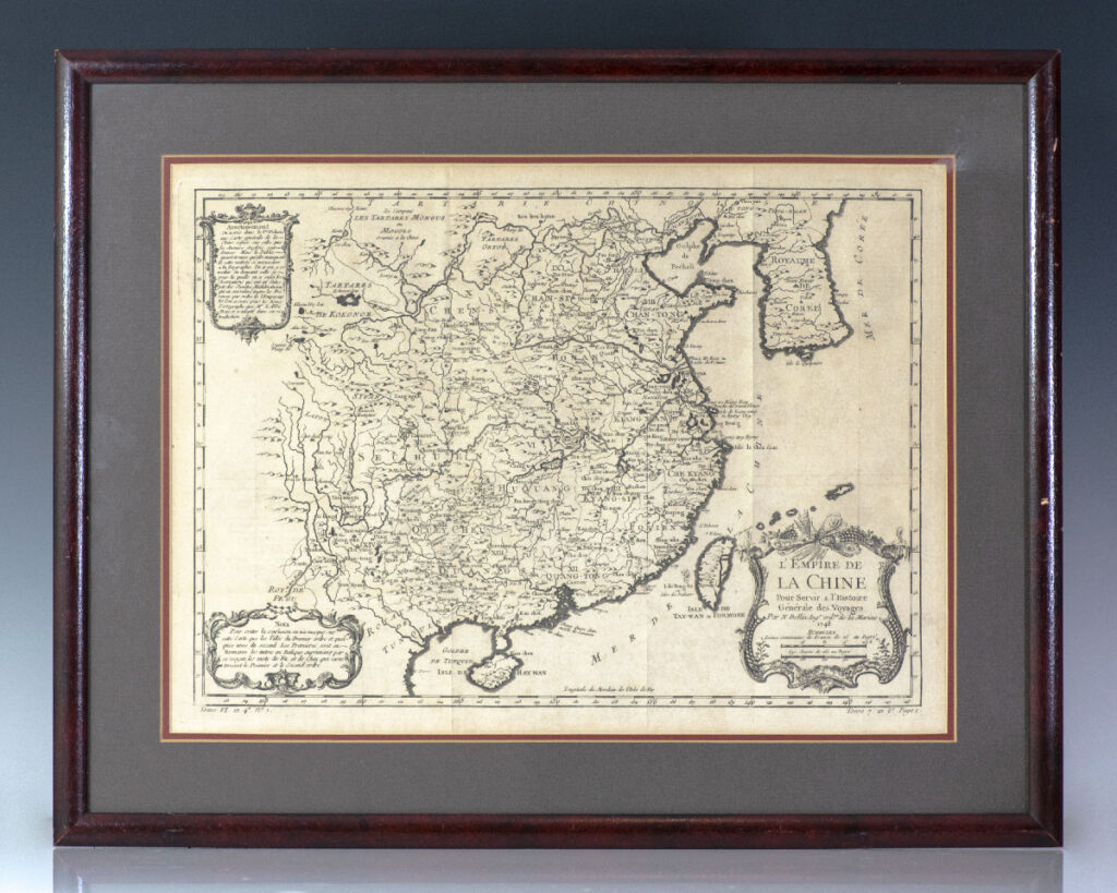
![L’Empire de La Chine Pour Servir a l’Histoire Generale des Voyages. [Eighteenth Century Jacques-Nicolas Bellin Map of China].](https://raptis.bvbeta.com/wp-content/uploads/2026/01/RRB-137234.jpg)


![L’Enfer de Dante Alighieri. Avec Les Dessins de Gustave Dore. [Dante’s Inferno].](https://raptis.bvbeta.com/wp-content/uploads/2026/01/RRB-137107.jpg)