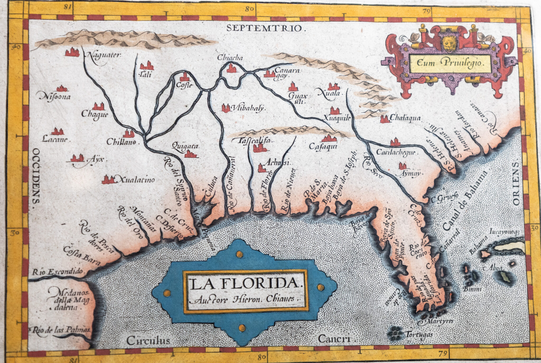
![La Florida. [The Earliest Separately Printed Map of Florida from Oretlius' Theatrum Orbis Terrarum].](https://raptis.bvbeta.com/wp-content/uploads/2026/03/RRB-151242-scaled-1.jpg)
ORTELIUS, Abraham.
La Florida. [The Earliest Separately Printed Map of Florida from Oretlius' Theatrum Orbis Terrarum].
The earliest separately printed map of Florida; from the 1609 Spanish edition of Oretlius' seminal Theatrum Orbis Terrarum
Antwerp: Abraham Ortelius, ca. 1592-1601.
$3,500.00
In Stock
Item Number: RRB-151236
* Custom Clamshell Boxes are hand made by the Harcourt Bindery upon request and take approximately 60 days to complete
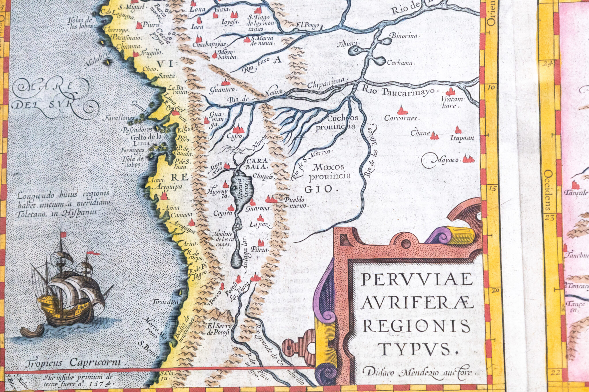
Abraham Ortelius' seminal map of Florida and the North American south with additional maps of Central and South America from the 1609 Spanish edition of Oretlius' Theatrum Orbis Terrarum. One page, engraved map with hand-coloring, divided into three smaller maps of Peru, Florida, and Guasteca based upon Spanish sources, specifically Geronimo de Chaves, the Royal Cosmographer to Philip II of Spain. The map of Florida is the earliest regional mapping of the South and Southeast and provided the foundation cartography for the region, especially the river systems. It is one of the earliest maps to show internal detail, based upon the findings of Hernando de Soto, as recorded by Gonzalo de Oviedo and first appeared in the 1584 Latin edition of Ortelius' Theatrum. The Peru map depicts the regions conquered by the Spaniards in 1531-33 in today's Central America and most of northern South America. Guasteca shows a portion of east-central Mexico along the Gulf of the Mexico coastline. The material was drawn from the Casa de Contrataction, one of the earliest examples of the dissemination of Spanish cartographic information from the New World. In near fine condition. Matted and framed. The entire piece measures 28.5 inches by 23.5 inches.
La Florida. [The Earliest Separately Printed Map of Florida from Oretlius' Theatrum Orbis Terrarum].
$3,500.00
In Stock
![La Florida. [The Earliest Separately Printed Map of Florida from Oretlius’ Theatrum Orbis Terrarum].](https://raptis.bvbeta.com/wp-content/uploads/2026/03/RRB-151242-scaled-1-1024x820.jpg)