MATHER, William Williams.
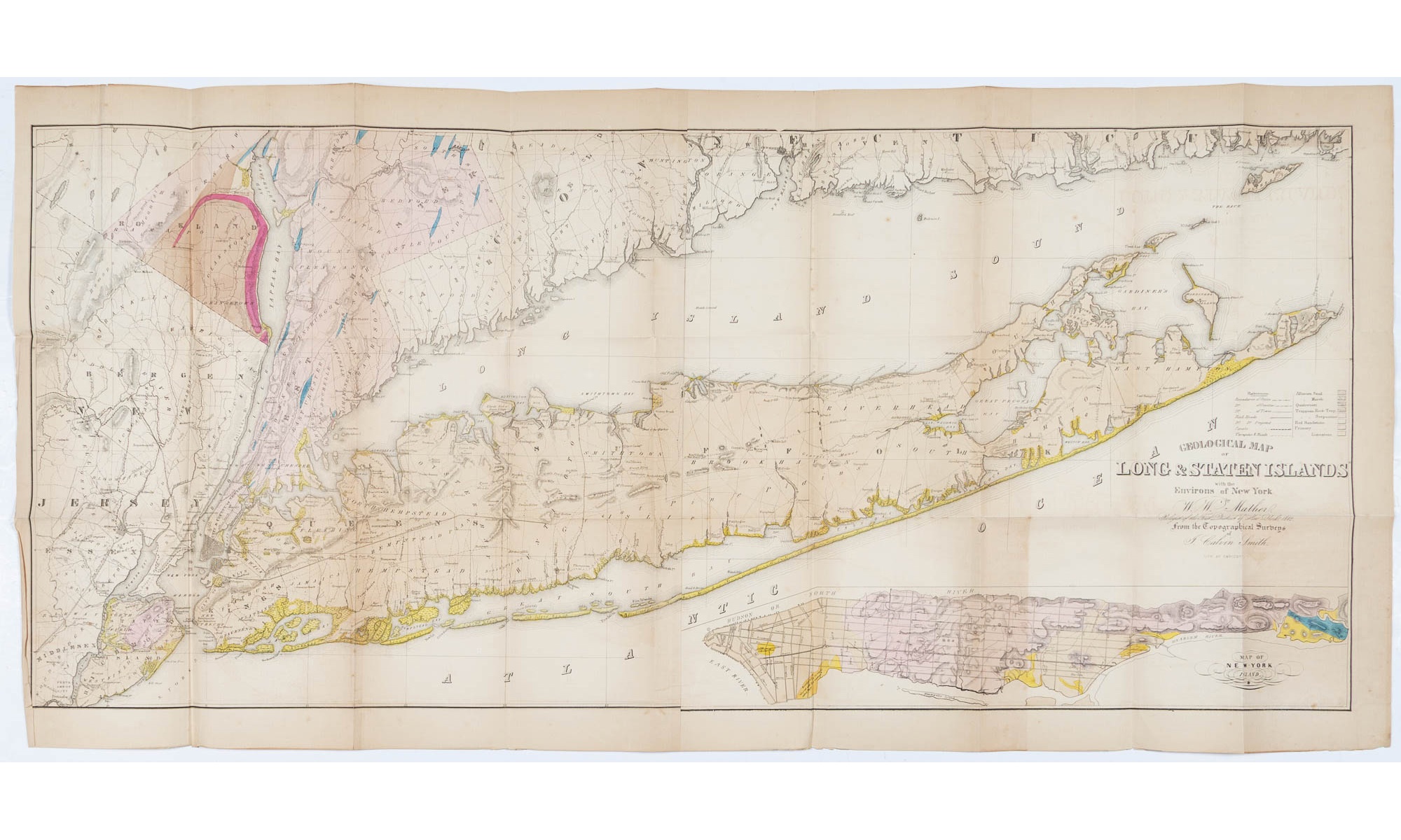
Geological Map of Long & Staten Islands with the Environs of New York From the Topographical Surveys of J. Calvin Smith.
Geological Map of Long & Staten Islands with the Environs of New York The finest and largest map of Long Island of the period
New York:, 1842.
$2,800.00
In Stock
Item Number: RRB-148871
* Custom Clamshell Boxes are hand made by the Harcourt Bindery upon request and take approximately 60 days to complete
Rare hand-colored example of Mather's monumental pre-Civil War wall map of Long Island, the finest and largest map of Long Island of the period. One page, two sheets joined from the topographical surveys of J. Calvin Smith, and lithographed by Endicott. Issued with Mather's 1843 Geology of New York, the map offers fine detail of the island before the intense late 19th century population growth and the completion of the Long Island Railroad (terminates here at Half Hollow Hills). The areas from Westhampton through Montauk are particularly well delineated. In very good condition with toning and closed tears. The piece measures 53 inches by 25 inches.
Geological Map of Long & Staten Islands with the Environs of New York From the Topographical Surveys of J. Calvin Smith.
$2,800.00
In Stock
