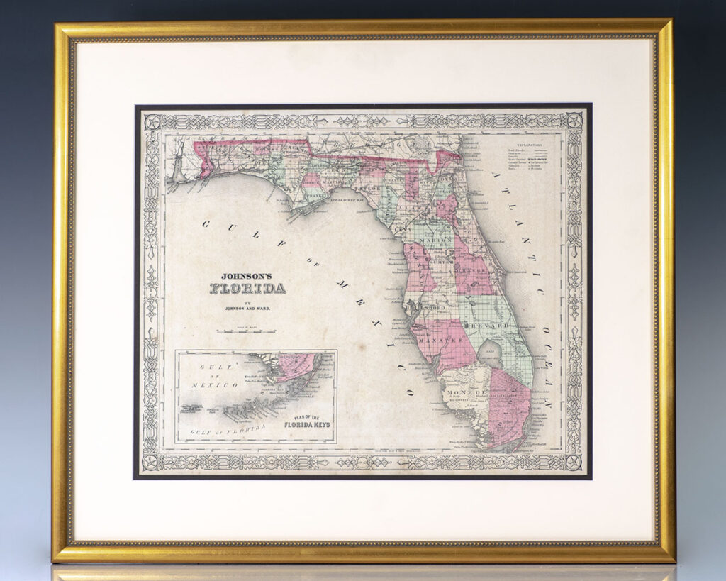
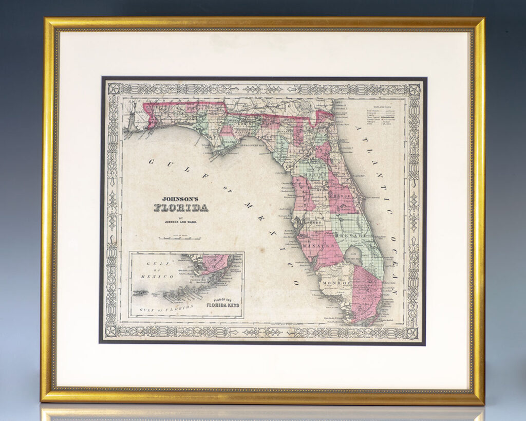
Johnson, Alvin Jewett and Ross C. Browning
Johnson’s Map of Florida.
New York : A.J. Johnson, c. 1861.
Rare 19th century example of Johnson’s famed Civil War era map of the state of Florida. One page, the hand-colored lithographic map depicts the state in full with color coding according to county in the midst of the American Civil War with references to towns, railroads, villages, depots, swamps, the territories of Native American tribes,Continue reading "Johnson’s Map of Florida."
Read more$1,750.00
Item Number: RRB-138533


![The Poetical Works of Henry Wadsworth Longfellow. [Fore-edge Painting].](https://raptis.bvbeta.com/wp-content/uploads/2025/12/RRB-138812.jpg)


![The New Whole Duty of Man, Containing the Faith as well as Practice of A Christian: Made Easy For the Practice of the Present Age, AS the Old Whole Duty of Man was design’d for those unhappy Times in which it was written: And Supplying the Articles of the Christian Faith, Which are Wanting in that Book. Though Essentially Necessary to Salvation. [Fore-Edge Painting].](https://raptis.bvbeta.com/wp-content/uploads/2025/12/RRB-138215.jpg)
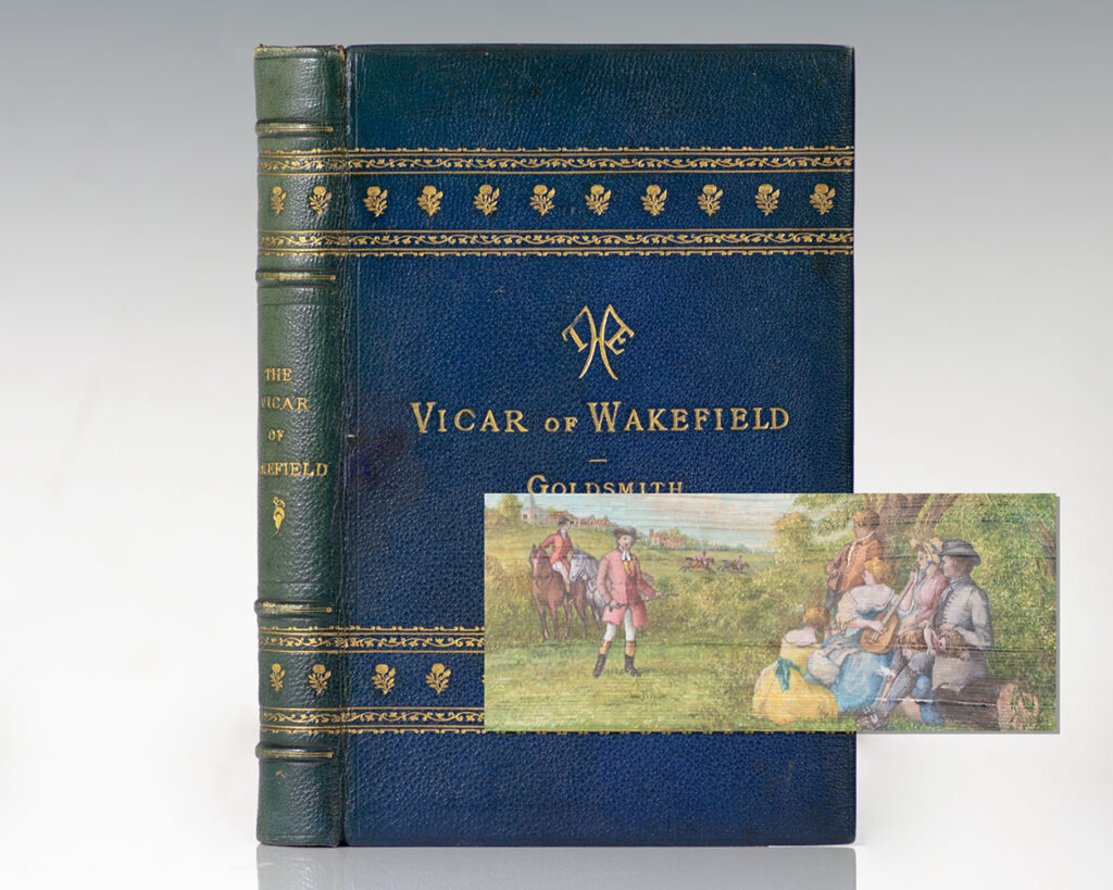
![The Vicar of Wakefield: A Tale. [Fore-edge Painting].](https://raptis.bvbeta.com/wp-content/uploads/2025/12/RRB-138744.jpg)
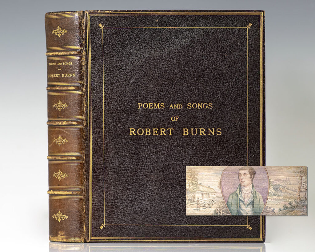
![Poems and Songs of Robert Burns. [Fore-edge Painting]](https://raptis.bvbeta.com/wp-content/uploads/2026/01/RRB-138654.jpg)