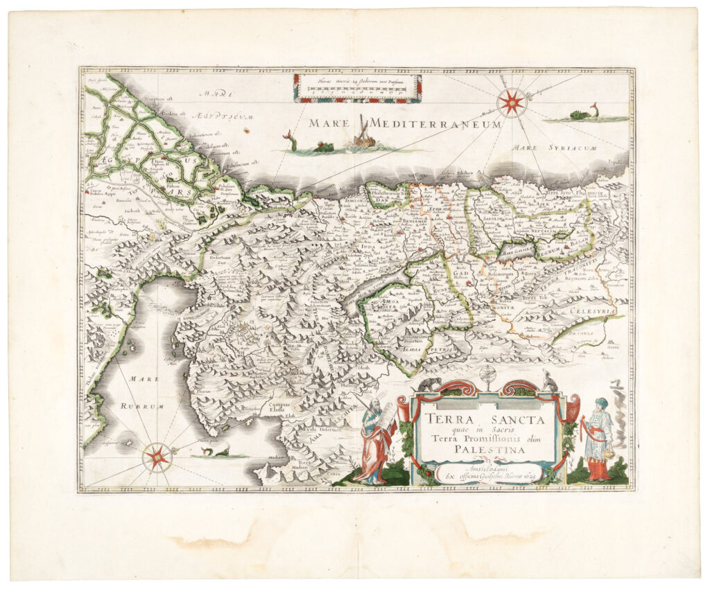
[Hondius, Jodocus]
Terra Sancta quae in Sacris Terra Promissionis olim Palestina [Holy Land Map].
Amsterdam : Blaeu, Willem, 1629.
Copper engraved, hand-colored map of one of the most decorative maps of the Holy Land of the 17th century. One page with hand-colored borders, the map depicts the tribes of Israel and the route the Israelites took from Egypt through Sinai into Canaan. In the sea there are three sea monsters, one of which hasContinue reading "Terra Sancta quae in Sacris Terra Promissionis olim Palestina [Holy Land Map]."
Read more$2,500.00
Item Number: RRB-147519


![Terra Sancta quae in Sacris Terra Promissionis olim Palestina [Holy Land Map].](https://raptis.bvbeta.com/wp-content/uploads/2025/12/terra537215_xl.jpg)