RUSSELL, John.
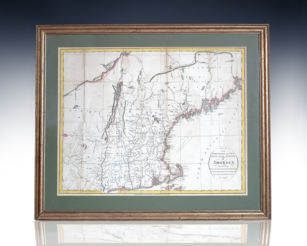
Map of the Northern, or, New England States of America. Comprehending Vermont, New Hampshire, District of Main, Massachusetts, Rhode Island, and Connecticut.
London: H.D. Symonds , Feb. 7, 1795.
$1,500.00
In Stock
Item Number: RRB-146812
+$450
one of the few commercial maps of New England issued immediately following the American Revolutionary War: fine Hand-colored engraved map of New England by renowned 18th century English cartographer John Russell
Hand-colored engraved map of New England by renowned 18th century English cartographer John Russell, one of the few commercial maps of New England issued immediately following the American Revolutionary War which appeared in Russell's 1795 American Atlas. One page, the folding map covers the northeastern part of the United States including part of New York and the entirety of Vermont, New Hampshire, Maine, Massachusetts, Rhode Island, and Connecticut. In near fine condition. Matted and framed. The entire piece measures 23 inches by 19 inches.
Map of the Northern, or, New England States of America. Comprehending Vermont, New Hampshire, District of Main, Massachusetts, Rhode Island, and Connecticut.
$1,500.00
In Stock